The White Mills Bridge, Explained — Meet Hardin County’s Engineer
The historic White Mills Bridge is closed. Hardin County Engineer Mark Absher explains what happened, the plan to preserve it, and the work behind the county’s 600 miles of road.

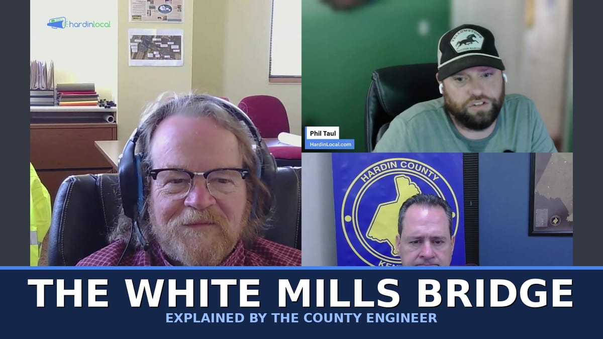
The historic White Mills Bridge is closed — and the decisions about what happens to it next run through one county office most of us have never thought about. This month on Hardin Local with Hardin County Government, we put a face to that office. Hardin County Engineer Mark Absher joined host Phil Taul and county communications officer Brian Walker to explain the bridge, the roughly 600 miles of county road, and the work behind both.
The White Mills Bridge
For folks who hadn't heard: the bridge at White Mills — a beloved landmark near the church camp, and a fixture of the community's fall festival and duck race — was closed after a routine state inspection a few weeks ago. The bridge is around 127 years old. It was refurbished in 2012, when a couple of structural members were replaced, and it has carried traffic ever since.
This time, inspectors flagged two more members that didn't pass, plus some additional items, and ordered the bridge closed out of an abundance of caution while the county figures out the right path forward. Absher, whose background is in structural engineering, has been working directly with the state's bridge inspectors — six of them climbed all over the bridge during a site visit this week — and the county is now consulting a Lexington firm that specializes in restoring steel structures.
The message from the county is clear: the goal is to preserve the bridge, not replace it. As Absher put it, keeping the bridge is the number one priority, and he said no one in county government has suggested simply letting it go. The harder questions now are how to preserve it and where the funding comes from — a coordination effort across the county and the state.
For now, the bridge is closed to all traffic, including pedestrians. There are stone barriers and "bridge out" signs at both ends, and the county is asking everyone to stay off it — both to avoid putting any additional load on the structure and to keep people safe. The detour is short (a little over a mile), but residents on either side should plan to come and go from their own side of the river.
One practical heads-up from the show: navigation apps like Google Maps may still route drivers — including delivery trucks — straight over the closed bridge. Don't follow it. Heed the posted signs.
What a county engineer actually does
Most residents have never met their county engineer, even though the office touches nearly everything: the roads you drive, the bridges you cross, and the way water drains off your property.
Absher is a civil engineer — and as he explained, "civil" is essentially short for civilization. Civil engineers build and maintain the systems that hold a community together. The job runs from reviewing the storm drainage and road design on new subdivisions, to managing the county's floodplain rules, to traffic and sign questions, to tracking the condition of every county bridge.
A few things that surprised us:
- Roughly 600 miles of county road. Figuring out whether a given road is county, city, state, or private isn't always obvious. A quick tip from Absher: county road signs in Hardin County are typically green, and county sign posts use a "U-channel" style. State routes usually carry a number and have painted center and edge lines.
- A new subdivision road isn't automatically the county's. If a developer builds a road and simply wants the county to take it over, that's not how it works — the road has to be built to county specifications (bed, surface, width, drainage) and go through the proper process first.
- A bridge vs. a culvert comes down to 20 feet. The state defines a bridge as a structure with a span longer than 20 feet; below that, it's generally a culvert. Hardin County has 37 bridges the state inspects on a rotating one-, two-, or four-year schedule.
How roads and bridges get prioritized
Everyone thinks their road should be next. So how does the county actually decide? Rather than judging it internally, the county contracted a third party (through Lincoln Trail) to perform a pavement condition rating on every road in the county and build an objective scoring system. Sometimes a road that looks rough is structurally solid, and sometimes a road that looks fine is failing underneath — the rating accounts for that, and condition drives priority.
Bridges get a similar treatment: the state conducts the inspections, Absher tracks every report in a running spreadsheet, and the county ranks them from poor to fair to good so nothing slips through the cracks.
And yes, paving has a season. Asphalt plants can't run in freezing weather, so full repaving ramps up in the warmer months, while cold-patch pothole repairs happen year-round.
The tech behind the roads
The work looks a lot different than it used to. Drones now save the office enormous time — a site that once took hours to survey on foot can be mapped from the air in about 30 minutes, with photos and video to document it. And the county's GIS mapping (the searchable map on the county website) lets staff and residents alike see county roads, blue-line streams, floodplain boundaries, and more.
How to reach the office — and report a problem
See a pothole, a downed stop sign, or a drainage issue? You have a few options:
- TextMyGov — a quick way to report issues and stay informed.
- Call or email the Hardin County Road Department.
- Not sure whose road it is? Use the searchable GIS map under "Engineering" at HardinCountyKY.gov.
You can also find the full county staff directory — including the engineer's office — at HardinCountyKY.gov. And don't forget to sign up for RAVE Alerts there, the county's emergency notification system, which is how you'll hear fast if a road closes or a bridge goes out.
Hardin Local with Hardin County Government is a monthly series connecting Hardin County, Kentucky residents directly with the departments and people who serve them. Watch the full episode above, listen on Spotify and Apple Podcasts, and find every episode, article, and event at HardinLocal.com.